Services THAT WE PROVIDE

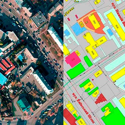
CREATING AND MAINTAINING
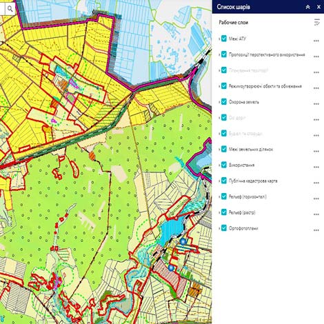
GEODATABASES OF URBAN CADASTRE
In order to provide information on the implementation of urban planning functions at the regional and local levels by executive authorities and local governments, as well as to meet information needs in the field of urban planning of organizations, enterprises, public associations and citizens on the basis of formation, integration, constant updating and effective use of geoinformation resources about the territory of the settlement with application of modern geoinformation technologies “BlomInfo-Ukraine” provides services for the creation and filling of the Geodatabase of the Urban Cadastre (hereinafter – GDB of UC), the means of its maintenance and publication of public data by publishing on the geoportal of the urban cadastre. Depending on the state of information support in each case (city, local community, village, etc.), the range of services may consist of various components of the infrastructure of the GDB of UC), pre-processing data and filling the database, as well as developing software and technological solutions database:
1. Formation of GDB of UC infrastructure.
2. Preliminary processing (preprocessing) of basic geospatial and thematic data of GDB of UC.
3. Initial filling of GDB of UC with available urban planning documentation and basic geospatial data.
4. Creation and implementation of software and technology modules for GDB of UC.
5. Creation and implementation of software and technological modules of tools for working with GDB of UC based on QGIS GIS software.
6. Creation of a geoportal of the urban cadastre and publication of relevant public information on it.
7. Organization of regulated access to data of GDB and data exchange with enterprises and organizations servicing engineering networks of the settlement (water, electricity, gas networks) and other subjects of urban planning activities.

PROCESSING CENTRE
With the introduction of decentralization reform, local governments are becoming increasingly important in society. With the acquisition of authority automatically comes the responsibility for the decisions made. There are no examples in Ukraine when a local government body has an up-to-date and complete information base of available resources. Creating such an information base and keeping it up- to-date enables the community to carry out land management or urban planning work at much lower cost, and in some cases land inventory work or a feasibility study may not occur. Our company operates throughout Ukraine and has more than 80 partner communities that participated in the USAID Agrosilrozvytok project. The result is the introduction of public transparent management of community resources, through the introduction of tools for publicity, discussion and solution of community problems. Full information is available at geoportalua.com. We are ready to share experiences, ready to help communities become capable through quality use of their own resources, for this we have a processing center that provides consulting support, assistance in data collection, database formation, publication on the portal of information necessary for management decisions.
COOPERATION WITH
UNITED TERRITORIAL COMMUNITIES
Communities are a new link in the management, development, communication and achievement of territorial development goals. Modern territory management is, first of all, a clear idea of its resources, their quantity, quality, condition and location. And with the use of modern GIS technologies, the management process becomes easier, management decisions are reasonable, and the work of a land surveyor is much more interesting. Today in Ukraine, the communities cooperating with “BlomInfo- Ukraine” are the first examples when the local self-government body has the most up-to-date and complete information base of available land resources. When the local government can make informed decisions and solve community problems through the efficient use of its own resources. After developing a scheme of modern land use, the community has the current actual state of land use. With the help of this information you can see the location of reserve lands, state and private lands, identify lands that are cultivated without paperwork. On the base of the scheme of modern use of community land we can develop vector of perspective development of your community, see directions, which are required to be developed and which become the visit card of your UTC. According to experts, when implementing the measures that will be proposed in the long run, the community budget will increase by an average of 30-40%, and areas will be found to meet the social needs of community residents. After all, the overall goal is to create favorable living conditions in rural areas, and for this we need work places for the inhabitants in the first place and meet their social needs. The system developed by BlomInfo-Ukraine is a living mechanism that needs to be updated and kept up to date. We recommend that you constantly monitor changes in land resources in your community through monitoring the solution of the problem and changes in the database, and thus there will be constant updating of information in your UTC. Only in this case, we can say that once the work will always be a relevant source of information for any management decisions.

AEROPHOTOGRAPHY
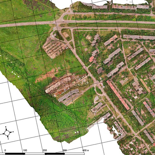
In the implementation of complex land management projects and for the development of cartographic products, BlomInfo-Ukraine traditionally orders aerial photography of large urban areas with multi-storey buildings to its partners Aviation Settlement Center LLC (Kyiv), which has digital cameras with large Ultra format matrix or Microsoft Vex Geosystem (Vinnytsia), which works with Leica ADS40 digital scanning cameras.
For aerial photography of rural settlements, BlomInfo-Ukraine uses its own unmanned aerial cartographic complexes (further UACCs), which are extremely effective and almost indispensable for mapping small areas and low-rise buildings. UACCs allow you to quickly obtain up-to-date data for further processing and creation of high-quality data products with minimal costs.

PROCESSING AND MODELING OF GEODATA
We have advanced methods of data processing obtained during aerial photography. Our specialists and work experience allow us to guarantee that, as a result of processing and modeling processes, you will receive the necessary high-quality geodata products in a timely manner and at a competitive price.
ORTOPHOTOPLANS
Traditionally for Ukraine we manufacture orthophotoplans of medium scale (from 1:10 000 to 1: 5,000, GSD 40 cm) and large scale (from 1: 2,000 to 1: 500, GSD from 15 to 7 cm). For projects that require high precision, we can offer the production of orthophotoplans ultra-high resolution GSD from 5 to 2 cm.
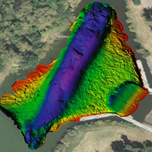
HIGH-ALTITUDE MODELS
Creating high-altitude models can be done using photogrammetric methods. Digital altitude models give a mathematical representation of the altitude characteristics of terrain and objects.
Types of models:
▶️ DTM – digital terrain model of relief or earth’s surface;
▶️ DEM - digital terrain elements model (additionally included elements on the earth 's surface, such as houses and vegetation..
High-altitude models are used in many spheres, such as:
• planning and design of roads, railways, power lines, pipelines, etc .;
• modeling the risks of floods, landslides, avalanches, industrial activities;
• agricultural activities;
• geological and geotechnical relief analysis;
• modeling and planning of built-up areas;
• modeling of noise propagation;
• study of the environment and ecology;
• orthorectification of aerial photographs.
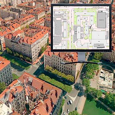
CARTOGRAPHIC SERVICES
We have extensive experience in providing professional services for the creation of a variety of digital cartographic products of any level of complexity and completeness of display. The list of services includes both the complete creation of the map and its updating or addition. Using gained experience we have the opportunity to provide data structured in accordance with modern requirements of such industries as urban planning, engineering design, ecology, private business, forestry, agriculture, as well as to meet additional needs and support additional customer services. To create digital maps, we can use orthophotos, space images, paper source cartographic materials and diagrams, and more. The result of our work is a digital cartographic product that fully meets the specifications, requirements of national and international standards and is ready for integration into any GIS environment.
USAGE:
• Urban planning and spatial planning;
• Engineering and design;
• Cadastre and land management;
• Navigation;
• GIS analysis and modeling;
• Publication of printed cartographic products.
VECTORIZATION AND DIGITATION OF DATA
As paper mapping is a thing of the past and the need for flexibility in managing large amounts of data stored within specialized Client systems is growing, BlomInfo-Ukraine offers a wide range of options and approaches to converting paper maps and charts into digital format, making them suitable for direct import to the GIS environment used by the Client. We are able to create files in any CAD or GIS format, such as AutoCAD (DWG, DXF, MicroStation (MicroStation (DGN)), ArcView (SHP), ArcInfo (Coverage) and many others.

OWN GEODATABASES
Using existing geodatabases can reduce the cost of your project. We offer the implementation of cartographic projects using our own database of cartographic data.
If the territory of your project is not included in our database, we will help you find the best version of the available data and provide a transparent procedure for creating the final product based on them.
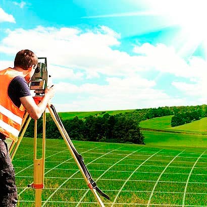
TERRESTRIAL TOPOGEODESIC WORKS
Terrestrial topographic surveys are a traditional basic service for BlomInfo-Ukraine.We have extensive experience in many types of terrestrial topographic works, including:
• Plan-height binding of aerial photographs;
• Creation of geodetic networks;
• Detailed topographic surveys;
• Assembling cross / longitudinal drawings;
• Preparatory work for the construction of engineering networks;
• Tracing of underground communications;
• Mapping of linear objects;
• Establishing the boundaries of the land in kind (on the ground);
• Installation of coastal protection strips;
• Field decryption, geocoding and updating of address plans.
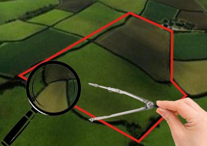
LAND MANAGEMENT and CADASTRE
BlomInfo-Ukraine offers professional consulting services and development of unified documentation for effective land management.
Main types of services:
• Establishment (change) of the boundaries of administrative-territorial entities;
• Organization and establishment of boundaries of the territories of the nature reserve fund, health, recreational and historical-cultural purposes;
• Land management projects for landscaping of settlements;
• Land inventory;
• Inventory and creation of a single documentation for the efficient use of resources of the united territorial communities;
• Installation of water protection zones and coastal protection strips;
• Land management projects that provide ecological and economic justification for crop rotation and land management;
• Change of purpose of the land plot;
• Execution of documents for the land plot for entering information about it in the State Land Cadastre;
• Production of cadastral maps, plans and copies of them;
• Land management projects for allotment, division or consolidation of land plots;
• Normative monetary valuation of land;
• Expert monetary valuation of land.
GIS SERVICES AND ANALYSIS
Using the latest technology and constantly improving the production process, we are able to provide geospatial data suitable for use in any GIS environment, meeting both the requirements of future users and accepted industry standards.
Our services cover work from modern statistical analysis and consulting to software development. We are able to use our resources to help customers make the best use of geographic data with the most advanced solutions to meet their personal requirements when creating automated systems of urban and land cadastre.